By Michael Kurdyla and Chris McCall
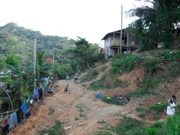
In the dry season, roads are treacherous slopes of rocks, garbage and other debris. In the rainy season, they become torrents of water, streaming downhill toward the Gulf of Mexico, a half a mile away. As the local infrastructure cycles between these two extremes, it can be difficult to discern whether any given path is an actual road or just another well-worn hillside. This is Balfate, a community of about 800 people in La Colonia, a shantytown on the Honduran island of Roatán. The community is home to workers and their families who left behind their lives and homes on the Honduran mainland for the chance of a better life. They have jobs as taxi drivers, waiters, housekeepers – essentially anything that needs to be done to support the local tourism industry, which centers on the coral reef right offshore.
Since 2007, Balfate has been the annual destination of Project Honduras, a student-run sustainable development project at the Georgetown Public Policy Institute. Project Honduras was created to connect GPPI students to an underserved community and give them the opportunity to use their policy skills to create change. For the last four years, students have traveled to the island over Spring Break to implement ongoing service and development projects, the planning of which engages the students throughout the academic year.
During a weeklong visit to Roatan in March 2011, the Project Honduras team embarked upon the first thorough survey of Balfate ever performed by a community assistance organization. Over the course of three days, team members traversed the hillside in pairs, armed with cameras and notepads to document the locations of homes, businesses, apartment buildings, other dwellings, and undeveloped properties.
Many areas of the community had not been visited by previous Project Honduras groups, who focused their work on the school just inside the entrance to the community.
While initial estimates suggested that there were 90 homes in Balfate, it became obvious via satellite mapping and surveying that this number was much too low. The team found that increased migration and development had almost doubled the number of families living in the area.
Meanwhile, engineers accompanying the team carefully mapped out the community’s water management system, including well locations and distribution zones. They recorded every last foot of PVC piping used to take water from Balfate’s storage tank to individual homes.
The community map features careful descriptions and locations for each of the community’s 170 homes. The map will prove invaluable for future GPPI teams that work in Balfate as Project Honduras continues its water intervention and works to monitor its progress. Thanks to last year’s accomplishments, the team will be able to match the baseline survey data collected in March 2011 with a follow-up assessment to be completed upon culmination of a household filter intervention. The map will also facilitate other initiatives that Project Honduras would like to pursue in the future, including infrastructure, health, and nutrition.
To learn more about Project Honduras, visit the organization’s Facebook page by searching for “GPPI Project Honduras” or contact Chris McCall at projecthonduras1@gmail.com.
Established in 1995, the Georgetown Public Policy Review is the McCourt School of Public Policy’s nonpartisan, graduate student-run publication. Our mission is to provide an outlet for innovative new thinkers and established policymakers to offer perspectives on the politics and policies that shape our nation and our world.